Our Landscape
The Columbia Plateau
As you travel across eastern Washington’s arid lands you will see an intricate mix of shrub steppe, grasslands, wheat fields, irrigated crops, orchards and vineyards, wetlands, streams and lakes, and rocky outcrops and cliffs. This landscape supports over 235 plant and wildlife species, while producing billions of dollars in crops and livestock annually.
![]()
The Ice Age Floods
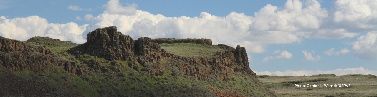
The diverse and sometimes majestic landscape of the Columbia Plateau owes some of its most striking characteristics to the Ice Age Floods. As their name conveys, these were multiple floods that occurred during the last Ice Age (18,000 to 12,000 years ago). Glacial Lake Missoula, a 500 cubic mile lake in Montana, formed behind a massive ice dam created by a lobe of the Cordilleran ice sheet as it cut across what is currently Lake Pend Oreille. Every 40 to 140 years, the water from Lake Missoula broke through the dam, and flooded across eastern Washington on its way to the ocean. The magnitude of these floods—peak flows are estimated at 10 times the combined flows of all the rivers in the world today—carved the salient features of the Columbia Plateau. They scoured the Channeled Scablands, carved Grand Coulee, Moses Coulee and others, and deposited sediments wherever the flood was temporarily checked, such as upstream of Wallula Gap, down the Willamette Valley in Oregon, and, ultimately, hundreds of miles from the mouth of the Columbia River, on the ocean bottom.
![]()
The Natural Landscape
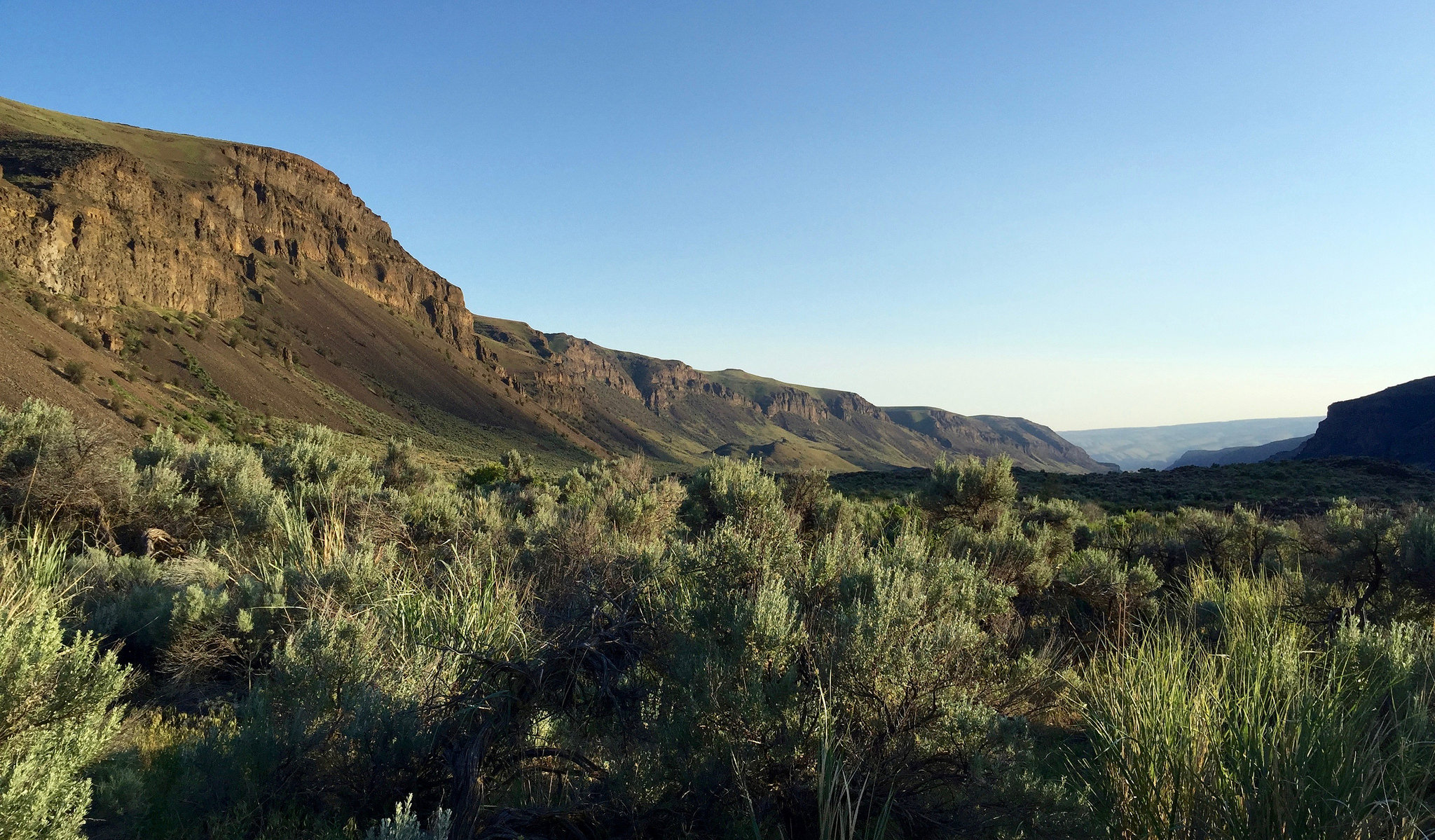
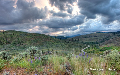 Though Washington is known as “the evergreen state” thanks to its lush, green west-side forests, the Columbia Plateau ecoregion, which covers one third of the state, has rainfall that is scarce enough that trees are hard-pressed to persist. The native habitats in this region are both subtle and diverse. Even the dominant shrub steppes vary from place to place, depending on rain and snowfall, topography, and soil characteristics. From the deep-soiled sagebrush steppe—much of which has been converted to agriculture, thanks to its deep, productive soils—to the Palouse grasslands and rocky scablands, the “sagebrush sea”, as it has been called, is an intricate mix of plant communities with different characteristics, that support different species at different times of the year.
The Columbia Plateau is also dotted and intersected by a diversity of other habitat types. Flood-formed coulees create surprises as you travel across the area. Lakes, ponds, and wetlands appear, concentrated in areas where glacial sheets have left accommodating pockmarks across the land, or where irrigation runoff provides a source of water. Waterways, from creeks to massive rivers like the Columbia and the Snake, follow contorted pathways on their way to the ocean, supporting diverse and valuable riparian habitats along their banks. And as you get to the edges of the ecoregion, at higher elevations, woodlands presage the transition to the forests that dominate the Cascade and Rocky Mountain landscapes.
![]()
The Region’s Agriculture
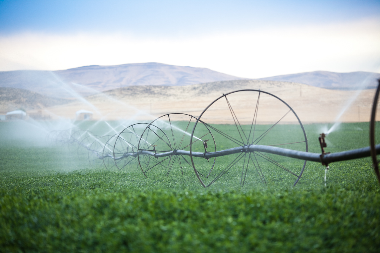
The Washington State Department of Agriculture calls agriculture “the cornerstone of Washington’s economy.” And though this refers to the state as a whole, the value and importance of agriculture as a regional economic driver is even greater in eastern Washington. As stated by economists at Washington State University, “Agriculture is the central economic driver for most communities, both small and large, east of the Cascade Mountains.”
Eastern Washington farms produce a diversity of agricultural products: meat, dairy products, fruits, vegetables, grains, wine grapes, and specialty crops like hops (for beer) and blueberries. The abundance and diversity of production—and the economic value our communities derive from it—are possible thanks to the range of environmental conditions conducive to this type of production. This abundance is evidenced in the fact that eight of the top ten counties in the state (based on the market value of their crops and livestock) are at least partly within the Columbia Plateau. In 2012, the combined agricultural market value of these counties reached $6.6 billion. Eastern Washington is also home to five of the top ten counties for food processing sales in the state, which add another $4.1 billion in gross sales.
![]()
The Mighty Columbia River

Flickr user Georgia, under CC BY-NC-ND 2.0
The Columbia River, the fourth largest river in North America (by volume), runs through the Columbia Plateau, and is in many ways the lifeblood of human activity in the region. Dams and reservoirs along its whole length enable the production of electricity that supports the economy and the needs of industry and communities in the region and beyond. These dams were also created to moderate and regulate flooding along the river. Water from this river feeds the Columbia Basin Project, which has allowed over 670,000 acres of agricultural lands to be irrigated, supporting the strong fruit and vegetable production industries, as well as others.