Implementation
The Arid Lands Initiative partners (and others working on conservation and resource management issues across the Columbia Plateau in Washington State) are using the ALI’s shared priorities to guide or inform their decisions. Here are some examples of projects that have used the ALI’s science products and contribute to the ALI’s shared priorities.
2016 and 2017
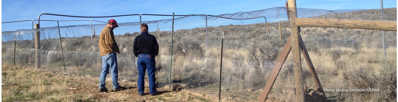
Bureau of Land Management – Restoration
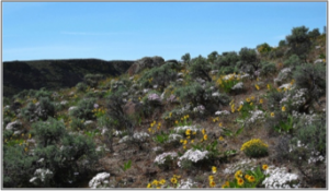
Roadside fuel breaks, Lincoln County. https://www.lincolncd.com/wildfire-hazard-reduction-cost-share
BLM’s 2014 application to have the Columbia Plateau named as a Healthy Lands Initiative focal area included reference to both their participation in the Arid Lands Initiative partnership and the ALI spatial priorities as justification for a focal area designation. Their application was successful, and the Spokane District has received over $500,000 to date for restoration and regulatory preparation work necessary before new restoration projects can be implemented. This funding is going towards: (a) developing fire breaks in key locations in Lincoln County, to protect sage grouse habitat; (b) starting a restoration project in Douglas Creek (Douglas County); and (c) starting a pilot project to test methods to biomagnify native soil crusts, to “seed” areas burnt in wildfires or destroyed in other degraded areas.
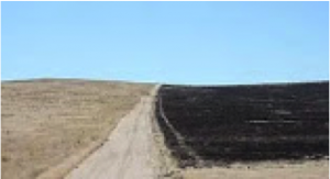
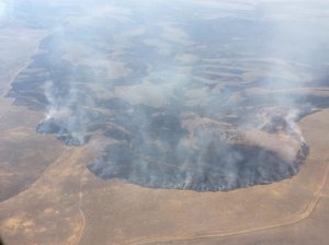
Federal Coordination on Post-Fire Response
2017 Silver Dollar Fire. Photo: Matt Giddens, Inciweb https://inciweb.nwcg.gov/incident/photograph/5306/2/64546/
The Bureau of Land Management and the US Fish and Wildlife Service have been coordinating on post-fire response. The 2016 Range 12 fire in south-central Washington burned 175,000 acres, including both BLM and USFWS-managed lands. Though each agency has its own mandate and requirements, staff coordinated and discussed their Emergency Stabilization and Rehabilitation plans. The recently contained Silver Dollar fire which burned 30,000 acres, overlapping partially the Range 12 fire’s burned area, and staff at BLM and USFWS are in communications, considering the possibility of developing a single ESR plan that both agencies contribute to implementing.
Conservation Northwest – Strategic planning
Carter Mountain Balsamroot. Photo: Justin Haug
Conservation Northwest, a conservation non-profit focused on “protecting and connecting old-growth forests and other wild areas from the Washington Coast to the BC Rockies,” is expanding its action areas to Washington’s arid lands, thanks in part to the Arid Lands Initiative’s vision. CNW is currently developing a conservation action plan for the “connected backbone” that runs north to south just east of the Cascades, using the same connectivity science that helped guide the ALI’s priorities, and engaging with ALI partners and others working in this landscape to help them identify where they can help and catalyze ongoing conservation efforts. They expect to finalize a five-year plan in spring of 2018.
Vantage to Pomona Transmission Line Update
Transmission lines over sagebrush steppe. Photo: Ann Froschauer/USFWS. CC BY-NC 2.0
The BLM’s Record of Decision includes a Mitigation Framework that requires a higher than baseline mitigation ratio on ALI priority core areas. That is, impacts from the transmission line in priority core areas need to be mitigated at a more than 1:1 ratio. Multiple ALI partners worked with Pacific Power during the assessment of alternatives for this project, and to create the Mitigation Framework (see Appendix F in the BLM’s Record of Decision). US Fish and Wildlife and other ALI partners continue to incorporate ALI priorities in assessments of energy and transmission projects in eastern Washington.
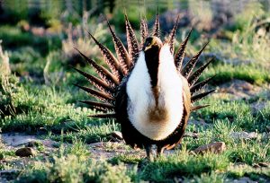
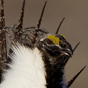
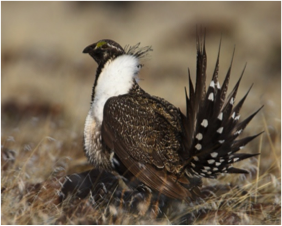
U.S. Fish and Wildlife Service – Sage Grouse
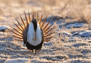
Greater Sage Grouse. Photo: Jennifer Hall. CC BY-NC 2.0
Multiple partners are concerned about and working to reverse recent declines in sage grouse numbers in the state. Efforts continue to strategically target programs to support these birds, including Conservation Reserve Program sign-ups, State Acres For wildlife Enhancement acres, the Douglas County Multi-species General Conservation Plan, and other habitat restoration efforts. For example, the US Fish and Wildlife Service continues to use the ALI data products to implement their sagebrush steppe conservation strategy in Washington, including projects that improve wildlife habitat on private lands through the Partners for Fish and Wildlife Program.
Natural Resource Conservation Service – Sage Grouse
Grazing plans as part of the Sage Grouse Initiative. Photo: Ken Miracle/USDA. CC BY 2.0
As part of the Sage Grouse Initiative, the NRCS has completed a grazing plan in Douglas County, where Sage Grouse Initiative and EQIP-funded improvements in water management, grazing management, and vegetation management around crop fields target improved value for sage grouse. They also hosted a workshop for landowners with SGI-funded projects to emphasize and share information useful in monitoring of SGI projects.
Natural Resource Conservation Service – Protection
Mix of agriculture and shrub steppe, in winter. Photo: Peter Prehn CC BY-NC-ND 2.0
NRCS is working with a landowner in Douglas County, on the plateau above East Wenatchee, to complete an agricultural easement on their property. The intent of the easement is to maintain the acreage as a working farm, with its current mix of dryland agriculture and native shrub steppe, in perpetuity. This is the first Agricultural Land Easement in Washington State, following a model that has successfully helped sage grouse and ranchers elsewhere across the West.
Community Forum – Wildfire and Resilience
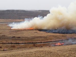
Prescribed fire at the Mid-Columbia River National Wildlife Refuge Complex. Photo: Brandon Lewis/USFWS. CC BY-NC 2.0
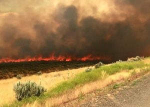
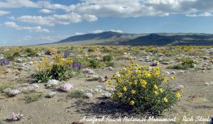
Recent wildfires in eastern Washington offer a stark reminder of the risk that these rangeland fires pose to people, livelihoods, plants and animals in the sagebrush steppe. Audubon Washington and multiple ALI partners, including Washington Department of Fish and Wildlife and the US Fish and Wildlife Servoce, are hosting a community discussion about reducing fire risk in sagebrush steppe habitats between the Yakima Training Center and the Hanford Reach National Monument. This landscape is one of the two areas the ALI is currently focused on that represent the largest tracts of remaining sagebrush steppe in Washington. Our goal is to build relationships with local landowners to identify areas of common concern and consensus actions we can then pursue together to reduce the risk of wildfire and improve wildland fire response in this landscape. Look for information on the community forum we are hosting to hear local landowners perspectives, concerns, and solutions, to be held in Yakima in October 2017.
Community Forum – Outreach to Local Coalition
 As part of the outreach work in preparation for the Community Forum, partners travelled to Yakima in June 2017 for a meeting of the Yakima Fire Adapted Community Coalition. We shared our interest in the Hanford-Yakima Training Center landscape and solicited their involvement in our project. A full room of staff from state, federal and local agencies—the Bureau of Land Management, the Department of Natural Resources, Department of Defense, county fire district chiefs and private landowners—participated in the lively discussion. There are many challenges to coordinating multiple fire jurisdictions and landowners, including limited funding for fire prevention and response. However, the Coalition was genuinely appreciative of ALI’s interest in the landscape, our willingness to ask hard questions and our forthcoming private landowner outreach efforts.
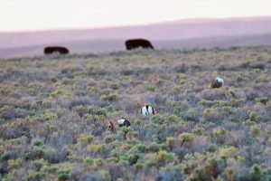
Audubon Washington – Shrub Steppe Breeding Bird Survey
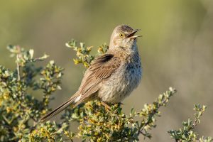
Sage Thrasher. Photo: Mick Thompson
Using the ALI Columbia Plateau ecoregional model seemed ideal to bring us together to implement a joint project for shrub steppe avian obligates. Audubon Washington, in consultation with our local chapters and in partnership with the Washington Department of Fish and Wildlife, created a multi-year shrub steppe passerine breeding bird occupancy survey for the public lands of the Columbia Plateau, now in its fourth year. The goal of our study is to inform conservation management by providing vetted data via eBird to the Washington Department of Fish and Wildlife’s Priority Habitat and Species Data base (PHS). PHS in turn is used for species management, State Wildlife Action Plans, Growth Management, and large-scale conservation efforts. Our data can also inform cooperative programs such as the Intermountain West Joint Venture HABPOPS and NRCS conservation and restoration programs.
Audubon Washington – Protection
The Hanford Reach National Monument. Photo: Dave Showater
The Lower Columbia Basin Audubon chapter led the effort to conserve a shrub steppe habitat through creation of the Hanford Reach National Monument in 2000, which anchors one of the largest ALI priority areas. Today the Monument is valued by the community both as a regional Monument and as an economic asset: it was the first National Monument taken off the rescind/reduce list by the federal administration July 2017. As the Department of Energy remediates lands in the central Hanford Nuclear Reservation, there is a possibility to protect even more shrub steppe habitat. Audubon is starting a local listening process to engage the community in a vision for appropriate shrub steppe conservation and public access of these assets. The importance of these lands in the broader sagebrush steppe landscape is captured in the ALI’s shared priority areas map.
Washington Department of Fish and Wildlife (WDFW) and US Department of Agriculture (USDA) – State Acres for Wildlife Enhancement (SAFE) program
CRP lands in Douglas County. Photo: Michael Schroeder.
SAFE is a USDA initiative focused on developing quality wildlife habitat through the Conservation Reserve Program – a voluntary incentive-based Farm Bill conservation program. WDFW private lands biologists provide technical assistance to producers enrolled in SAFE. With nearly 99,000 acres of shrub-steppe and grassland habitat enrolled as of June 2017, SAFE is improving habitat for sage-grouse, sharp-tailed grouse, ferruginous hawk, pygmy rabbit, and a host of other species of greatest conservation need throughout the Columbia Basin in Washington. Given the overlap between these species and their habitats and the ALI’s priorities, these 99,000 acres also contribute to achieving the ALI’s landscape-scale shared goals.
Ecological Integrity Assessments and Rare Plant Species Monitoring
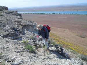
White Bluffs Bladderpod monitoring. Photo: Carrie Cordova/USFWS. CC BY-NC 2.0
The Washington Natural Heritage Program continues to develop and refine methods of evaluating the health of ecosystems and to standardize how data on plant species that are listed (or being considered for listing) under the federal Endangered Species Act are collected and reported. The health assessment, using a tool termed the Ecological Integrity Assessment, is being applied to various ecosystem types on Columbia Land Trust lands. Land trust staff are being trained in using this approach to identify and prioritize management actions needed to maintain and restore their lands. The species monitoring data have helped The Natural Heritage Program in the assignment of global and state ranks to the individual species, and to the US Fish and Wildlife Service, as they compile information for use in decisions regarding ESA status. Such sharing of methods and data helps inform and align partners’ efforts.
Washington Department of Natural Resources – Collaboration with Land Trusts
 As part of an effort to update the State of Washington Natural Heritage Plan, DNR’s Natural Heritage and Natural Areas programs have been engaged in an on-going conversation with land trusts in Washington to explore how better coordination and collaboration could result in more effective and efficient conservation across the state. The conversations have touched on information sharing, collaborative conservation planning, acquisition partnerships, and joint stewardship and outreach and education efforts. The conversations have also included the topics of connectivity and climate resilience, including how we might incorporate those concepts more fully into our conservation efforts, and how they might help shape individual projects for collaboration. Some of the data underlying the ALI’s shared priorities could potentially help identify areas where DNR and land trusts could collaborate to increase connectivity and resilience, thereby also helping to achieve ALI’s priorities.
Foster Creek Conservation District
 Foster Creek Conservation District (FCCD) has a number of programs in Douglas County, Washington that help farmers and ranchers preserve their resources, including shrub steppe, which in turn contributes to ALI’s shared goals. These programs include the Multiple Species General Conservation Plan, through which FCCD facilitates acquisition of permits that would protect farmers and ranchers from accidental harm to protected species and their habitat, based on their continued efforts to ranch or farm in ways that benefit those species. It also includes the Voluntary Stewardship Program, which promotes voluntary efforts to protect and enhance critical areas while maintaining agricultural viability. FCCD also helps farmers and ranchers complete conservation plans, a necessary step to be eligible for funding offered by NRCS, such as through EQIP and the Sage Grouse Initiative. ALI’s priority areas provide a valuable source of information that FCCD uses as a tool to evaluate private lands and habitat in the county at the landscape level.
US Fish and Wildlife Service – Landscape-scale recovery efforts
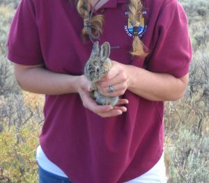
Pygmy rabbit recovery efforts. Photo: USFWS. CC BY-NC 2.0
As pygmy rabbit recovery efforts are showing success, reintroduced rabbits are breeding and dispersing to areas around the reintroduction sites, the USFWS and its partners are reassessing areas of potential habitat for pygmy rabbits, and how these areas are connected across the landscape. They will be considering a wide array of available data, including historical range information, and the landscape-scale priority areas shared across ALI partners. They will also be engaging an array of federal, state, non-profit and private partners in this endeavor, as experts and as land managers who may be interested or able to contribute to the recovery efforts through shared landscape-scale goals.
US Fish and Wildlife Service – Post-fire recovery
Range 12 Fire (2016). Photo: Kevin Stock https://inciweb.nwcg.gov/incident/photograph/4915/6/
The Mid-Columbia River National Wildlife Refuge Complex (including the Hanford Reach National Monument) has been focused on post-fire rehabilitation and enhancement, after the wildfire in Saddle Mountains in 2015, the Range 12 fire in 2016, and the Silver Dollar fire in 2017. Such efforts help recovery of native vegetation in burned areas in an area of significant concern to the ALI partners. Though such large scale efforts are challenging and require significant resources, the Refuge staff have gained experience into what techniques may be worth considering under what conditions.
Ducks Unlimited – Overlapping Priorities
Completed wetland and riparian restoration project on the South Fork of Crab Creek. Photo: Tina Blewett, May 2017.
Using ALI science-based tools adds value to projects that not only achieve Ducks Unlimited’s goals for waterfowl, but also provide benefits to other species, such as sage grouse or ground squirrels. The ALI priority areas map helps to identify areas where waterfowl species and their habitats overlap with the ALI’s shared priorities, and are opportunities to consider other species, especially when working with partners. One example is a wet meadow restoration project in the Telford area in Lincoln County. Proposed improvements include a ditch plug to prevent loss of spring run-off from this meadow system. This will allow the meadow to maintain more moisture into the dry season (June-August), beyond waterfowl spring migration (February-May), to provide habitat for amphibians, mammals, breeding waterfowl, and upland bird species, including sage grouse broods.
Post-fire recovery across ownership boundaries
Sutherland Fire (2017). Photo: Richard Parrish/BLM. https://inciweb.nwcg.gov/incident/photograph/5282/4/64375/
A challenge faced by land managers in the sagebrush steppe is to ensure areas that have burned are on the path to swift recovery, which may require post-fire restoration, and does not respond to ownership boundaries. In the wake of the 2017 Sutherland Fire in the Beezley Hills—which directly and indirectly impacted pygmy rabbit recovery efforts—BLM, Washington Dept. of Fish and Wildlife, and The Nature Conservancy teamed up to apply for Emergency Stabilization and Rehabilitation funding to support restoration efforts on public and adjacent private lands key to the pygmy rabbit recovery efforts. They plan to control weeds, restore old CRP fields, and fix fences impacted by the fire starting in the fall of 2017.
Sage Grouse Initiative in Washington
 Launched in 2010, the Sage Grouse Initiative (SGI) is a locally led, partnership-based, science-driven effort that is part of Working Lands For Wildlife, led by USDA’s Natural Resources Conservation Service. SGI’s partnership-based approach to conserver sage-grouse habitat aligns with ALI’s goals. In Washington, converting shrub-steppe to cropland is the primary cause of habitat loss and fragmentation. To date, SGI in Washington has worked with more than 70 landowners to facilitate sustainable grazing practices, effecting over 72,000 acres and obligating over $4.2 million in core sage grouse habitat. In 2017, SGI expanded its efforts in Washington to make the program available on cropland acres located within the priority area for conservation. Funding is now available to producers who convert marginal cropland back to permanent cover and/or improve the condition of “islands” and “eye-brows” of habitat that function as stepping-stones to larger and contiguous patches of sagebrush-steppe. Contact your local NRCS office to learn more.
Sage Grouse Initiative – Mesic Habitat
Greater Sage Grouse. Photo: BLM. CC BY 2.0
Additionally, SGI partners are working together in an effort to restore valuable and rare mesic systems throughout the 11 western states. Enhancing and protecting mesic areas provides environmental and economic benefits by building drought resilience, boosting forage productivity, and benefitting wildlife. In 2018, SGI will be able to provide financial assistance to producers who install hand-built rock and willow weirs designed to minimize erosion and raise the water table to increase water-holding capacity later in the season. Such work across the arid Washington landscape contributes to ALI’s goals for these same systems.
Multiple Partners Working for Wildlife
Crossing the Okanogan Valley. Photo: S.N. Johnson-Roehr Jr. CC BY-NC 2.0
Working for Wildlife is an initiative of the National Fish and Wildlife Foundation, bringing together partners to maintain and restore habitat of key species. By 2020, they aim to ensure lynx, mule deer and sharp-tailed grouse can move across the Okanogan Valley, through a viable linkage from the Cascades to the Rockies. Ongoing work includes conservation easements on private lands, wildlife underpasses on Highway 97, improved capacity of local organizations, development of wildlife plans with private landowners, and species-specific activities. The connectivity analysis that highlighted the Cascades-to-Rockies linkage also supported the selection of ALI priority areas, helping the Working for Wildlife projects contribute to our vision of a viable well-connected system of arid lands.
2015
Washington Department of Natural Resources – Natural Heritage Plan
Gordon L. Warrick, USFWS
WDNR’s Natural Heritage and Natural Areas Programs are updating their Natural Heritage Plan, with a particular focus on the East Cascades and the Columbia Plateau. The ALI shared priorities provide a landscape context—including connectivity and climate change considerations—to this effort, intended to identify areas to include in the Natural Areas Network in Washington. The ALI also helps highlight overlap between WDNR’s and partners’ priority areas.
Learn more
![]()
Washington Department of Fish and Wildlife – State Wildlife Action Plan
Gordon L. Warrick, USFWS
WDFW’s 2015 State Wildlife Action Plan has received public comment and is now approved. WDFW is complementing their traditional focus on species and ecosystems with places—priority landscapes—where focus is needed to “conserve iconic landscapes whose future status depends on collaboration across multiple jurisdictions and interests.” Once priority landscapes are identified, the ALI priorities will help inform the development of place-based landscape conservation action plans in WDFW’s Priority Landscapes in the Columbia Plateau.
Audubon Washington – Designations and Resilience
Rich Steele, USFWS under CC BY 2.0
Audubon’s Lower Columbia Basin Chapter is using the ALI’s shared vision to support efforts to add remediated lands to the Hanford Reach National Monument. Audubon Washington, in addition to supporting this effort, is looking to use the ALI spatial priorities and decision-support tools to inform decisions on areas and projects to enhance resilience of shrubs steppe habitats and birds to fire and climate change. ALI mapping was used to create and implement citizen science avian monitoring to provide gap data informing future conservation planning.
Cascadia Partner Forum – Connectivity to North Cascades
Dan Nevill under CC BY-NC-ND 2.0
The ALI shared priorities, as well as the Columbia Plateau Connectivity Analysis (which informed the ALI’s priority connectivity corridors), informed a synthesis by the Great Northern Landscape Conservation Cooperative’s (GNLCC) Cascadia Partner Forum, to articulate priority areas to connect the north Cascades landscapes with lower elevations ecoregions and neighboring mountain ranges.
Bureau of Land Management – Douglas Creek
Justin Kooy under CC BY-NC-ND 2.0
The Wenatchee Field Office of the BLM used the ALI’s spatial priorities to provide a landscape context during their Land Health Evaluation process in the Douglas Creek watershed. This evaluation informed multiple grazing lease renewals and upland and riparian restoration actions, some of which were challenged. BLM prevailed, thanks to the science foundation underlying their decisions.
2014
Natural Resource Conservation Service – Sage Grouse Initiative
Alan Krakauer under CC BY-NC 2.0
The Natural Resource Conservation Service (NRCS) has used the ALI shared priorities to inform decisions on where to reach out to private landowners to encourage them to sign up for the suite of programs nested under the Sage Grouse Initiative.
Federal and State partners – Grasslands of Special Significance
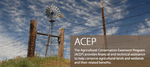 NRCS, U.S. Fish and Wildlife Service (USFWS), and other federal and state partners are using the ALI shared priorities to help delineate areas for possible Grasslands of Special Significance. A GSS-designation will guide efforts to obtain conservation easements through NRCS’s new Agricultural Conservation Easement Program, and would result in a higher proportion of easement costs being eligible for NRCS funding.
U.S. Fish and Wildlife Service – Conservation Agreements for Sagebrush Steppe Species
 A conservation agreement is a legally binding document about conservation actions agreed to by the Service and the land owner, that address the needs of fish, wildlife, and plant species within a specific area, while allowing land use activities to continue. For example, grazing under specific conditions can occur while protecting shrub-steppe habitat and greater sage-grouse. The ALI shared priority areas are informing decisions on where conservation agreements, such as candidate conservation agreements with assurances, should be pursued to yield the greatest conservation benefit to shrub steppe species and habitat.
U.S. Fish and Wildlife Service – Partners for Fish and Wildlife Program
 USFWS is using the ALI shared priorities to support prioritization of shrub-steppe restoration projects on private lands funded under the Partners for Fish and Wildlife Program.
Bureau of Land Management – Resource Management Plan Update
 The Bureau of Land Management’s (BLM) Spokane District is using the ALI shared priorities in their Resource Management Plan update process. The ALI spatial priorities are informing the restoration management actions included within the analyzed range of alternatives.
Bureau of Land Management – Healthy Lands Initiative
 BLM used the ALI shared priorities to support their nomination of the Columbia Plateau Ecoregion as a Healthy Lands Initiative Focus Area, which includes a request for project funding in two project areas corresponding to highly ranked ALI priority conservation areas, Lincoln County Scablands, and Moses Coulee. The requested funding is approximately $900,000 over five years.
Pacific Power’s Proposed Vantage to Pomona Heights 230 kV Transmission Line Project
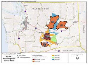 The ALI shared priorities have been used by the federal and state agencies who are ALI partners (BLM, USFWS, and WDFW) during the BLM’s environmental assessment of Pacific Power’s proposed Vantage to Pomona Heights Transmission Line Project. Specifically, the ALI priority core areas, considered key habitat essential to sage-grouse conservation and recovery, are being utilized in the development of Pacific Power’s Greater Sage-Grouse Compensatory Mitigation Plan to address the project’s residual impacts, and to aid in the identification of potential mitigation projects.
Washington Department of Fish and Wildlife – Grand Coulee Ranch
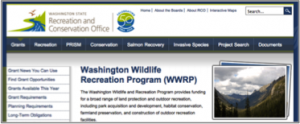 WDFW has used the ALI shared priorities and underlying information to provide supporting rationale for proposed acquisitions within the Columbia Plateau, namely applications for funding to acquire the Grand Coulee Ranch in Douglas County. The first phase of funding is complete, and the project is teed up for funding through Washington Wildlife and Recreation Program (WWRP), pending allocation decisions in the state budgetary process.